Skip to content

The entire library on the map, in the right version.

The operation's geospatial document management system. Each survey comes in once, with a code, version and metadata, and is found by search or straight on the map.

DataHub: library of geospatial data and designs
On screen

DataHub as it is.

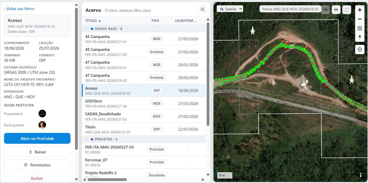
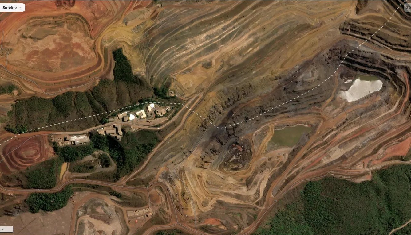
Map search in DataHub, over the satellite image
Map search: the area of interest over the satellite image
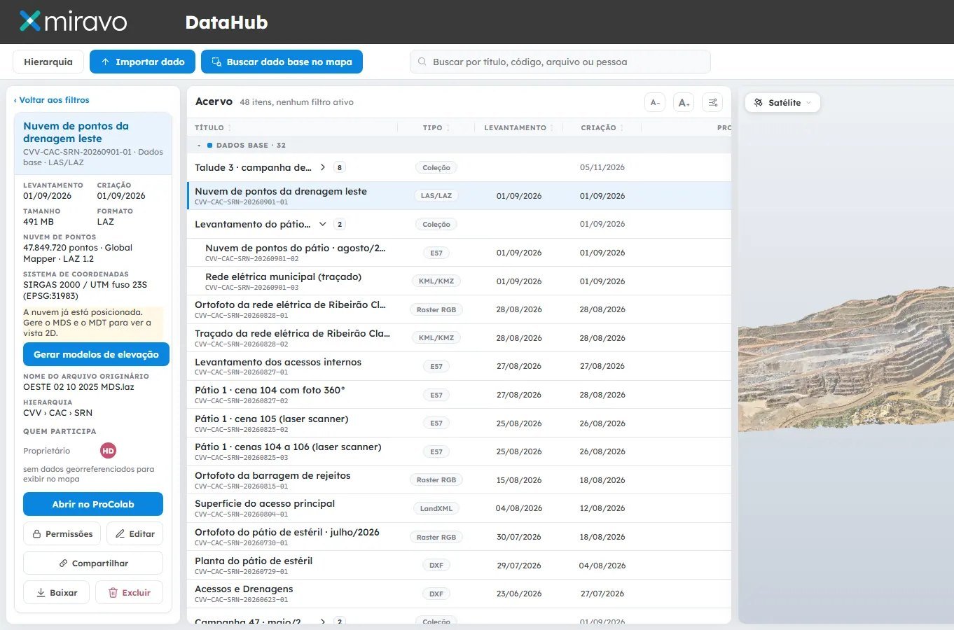
Record of a point cloud in DataHub, with coordinate system, source and 3D preview
Dataset record with coordinate system, source and the point cloud in 3D
67%

of the professionals surveyed have surveys scattered across emails, folders and computers.14 of 21 professionals · Miravo research, October 2026

How it works

Four steps, all on record.

01

Import

GeoTIFF, LAS/LAZ, E57 with 360° photos, DXF, KML/KMZ, SHP and LandXML, from any supplier.

02

Catalog

Geodetic system, resolution, format, date, source file and owner read on import, with a unique code.

03

Find

By code, title, type, date, person or location. Or on the map, with a preview of each dataset in its real position.

04

Share

A download link to the current version for people outside, valid for as long as you choose, with a record of who shared it.

For technical staff

The survey is on the map, not in an email.

For managers

The right version to decide on, with no rework.

Specifications

What DataHub does.

Input
GeoTIFF · LAS · LAZ · E57 · DXF · KML · KMZ · SHP · LandXML
Metadata
Geodetic system, resolution, format, date, source and owner
Organization
The operation's location hierarchy, unique code and collections by campaign
Versions
Current one highlighted, earlier ones kept in the history
Search
Code, title, type, date, person, location and map
Sharing
Link to the current version with an expiry, with a record of who shared it
FAQ

About the library and versions.

What is a geospatial document management system, and how is it different from a corporate one?
A corporate document management system finds a file by its name and folder. A geospatial one understands the data: it places each survey on the map, reads the coordinate system and the metadata and shows a preview, so you find a survey by the area where it was made. DataHub is Miravo's geospatial document management system.
How do you control versions of topographic surveys?
By giving each survey a unique code and recording each new campaign or revision as a version, without deleting the previous one. In DataHub the current version is highlighted and earlier ones stay in the history, with source, date and owner, and the record shows which projects use the data.
How do you find an old survey?
Through search by code, title, type, date, person or location, or on the map: go to the area and see everything ever surveyed there, with a preview of each dataset in its real position.
How do you send a survey to someone who does not use the platform?
With a download link to the current version, valid for as long as you choose. DataHub records who shared what and when, and the file stops travelling by email.
Which geospatial file formats does Miravo accept?
Orthophotos and surface models in GeoTIFF; drone and laser scanner point clouds in LAS, LAZ and E57, with 360° photos per station; drawings in DXF; KML and KMZ; shapefiles (SHP); LandXML. Output: DXF, SHP, KML, GeoTIFF and LAZ.
All questions →
Next step

See DataHub with a survey from your operation.

A 30-minute online demo, with a survey from your operation on the map.

Request a demo